


Special Weather Statement for Far North Georgia
Community January 5, 2022
Winter Storm Warning in effect for North Georgia
Community, weather February 6, 2021
BLAIRSVILLE, Ga – High elevations (1,500 and above) might experience up to three inches of snow overnight. Lower elevations can expect up to an inch of snow.
The Winter Storm Warning lasts throughout the weekend until 12 p.m. on Sunday, February 6 for Union, Towns, Lumpkin, Rabun, and White Counties.
According to the National Weather Service out of Peachtree City, Ga, travel could become difficult from snow on roadways. NWS recommends if traveling to keep a flashlight, food, and water in the vehicle.
Rabun’s expected to bear the brunt of the storm with “heavy snow and sleet expected. Total snow and sleet
accumulations of up to four inches.”
A winter weather advisory is in effect for Fannin, Gilmer, Pickens, and Dawson until Sunday at 12 p.m.
Total snow accumulation could be between one and two inches with possibly more at higher elevations. Only an inch is anticipation at the lower accumulations.
NWS asks drivers to use caution on the roads.
Road crews at work as snow blankets county
News February 8, 2020HIAWASSEE, Ga. – Towns County Road Department is hard at work, clearing area roadways to ensure safe passage for emergency responders and motorists who must travel. As the snow began to fall, with current reports of over 6 inches of accumulation in some locations, Towns County Commissioner Cliff Bradshaw continues to make the rounds with county road crews.
Numerous, minor accidents have been reported throughout the county.

Upper Hiawassee River, State Route 75 South.
Hiawassee Police Department advised motorists this morning to “please stay off the streets unless absolutely necessary.”
Blue Ridge Mountain EMC is reporting approximately 600 power outages in its area of coverage.
Winter precipitation is expected to taper off as the afternoon advances, with an overnight temperature of roughly 23 degrees. Partly sunny skies with temperatures in the 50s are in Sunday’s forecast.
Ice may form on area roadways after dusk. Please use extreme caution if travel is unavoidable.
“We would like to ask that travel be avoided if possible especially after dark due to freezing of wet and slushy roads,” Towns County EMA Director Brandon Walls told FYN. “We have also requested extra GDOT plow trucks to assist.”
The threat of possible localized flooding remains, Walls said, as the ground is saturated from recent rainfall and additional precipitation is anticipated to return next week. Walls urged residents to remain alert to changing weather conditions.
Follow FYN for further weather updates as developments occur.

Towns County Road Department at work.
Towns County spared brunt of stormy weather
News February 7, 2020
HIAWASSEE, Ga. – Towns County was narrowly spared the brunt of this week’s storms, with minimal flooding and no significant incidents or damage, other than downed trees, reported as a result of the rainy weather. Residents of Enchanted Valley RV Resort, however, closely monitored the quickly rising Hiawassee River, which runs along the banks of the mobile home park, ready to take action should the water continue to swell. Residents kept a close watch on their properties and the data provided by a river stage monitoring station on nearby Riverside Drive. The low-lying residential area is prone to flooding during periods of extended rain.

USGS river stage monitoring station at Riverside Drive.
In May 2018, heavy rainfall from Subtropical Storm Alberto resulted in the extensive flooding of Enchanted Valley RV Resort, located off of Highway 75 South, with Towns County first responders arriving on scene to assist in after-dark evacuations.
While the Hiawassee River did rise considerably in a short amount of time, Mother Nature was overall kind to the residents of a park that recently suffered the loss of three homes due to a structure fire.
“River stage is an important concept when analyzing how much water is moving in a stream at any given moment. Stage is the water level above some arbitrary point, usually with the zero height being near the river bed, in the river and is commonly measured in feet,” the U.S. Geological Survey (USGS), which gauges the water levels, website explains. “With the advent of modern computer and satellite technology, the USGS can monitor the stage of many streams almost instantly. Since some streams, especially those in the normally arid Western U.S., can rise dramatically in a matter of minutes during a major storm, it is important to be able to remotely monitor how fast water is rising ‘in real-time’ in order to warn people that might be affected by a dangerous flood. Recreational users of streams, such as kayakers, also use “real-time” stream-stage data to tell them if certain streams are at the right height for kayaking. The USGS can now gather data on river stage and even produce graphs showing stage as the rain is falling.”

USGS graph of the recent Hiawassee River water levels.
As the storms moved out of Towns County and the temperature decreased, slight precipitation remained in the atmosphere, resulting in a minimal amount of snowfall in portions of the county on the morning of Feb. 7. Another light dusting to a possible inch or more of snowfall is expected Saturday morning, Feb. 8.
Towns County Schools initially planned to operate on a two-hour delay, canceling campus classes entirely on Friday, Feb. 7, due to winter conditions.
Featured Image: The swift-moving Hiawassee River alongside Enchanted Valley RV Park, Hiawassee, GA
Towns County citizens, first responders trained as NWS storm spotters
News October 19, 2019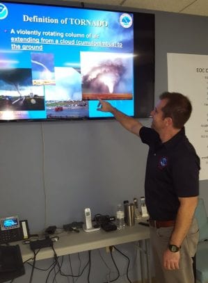
YOUNG HARRIS, Ga. – The National Weather Service (NWS), in cooperation with Towns County Emergency Management Agency (EMA), held a SKYWARN storm spotter class Oct. 18 at the Towns County Emergency Operations Center. Towns County citizens, along with first responders from Hiawassee Police Department, Towns County Fire and Rescue, and Towns County Emergency Medical Services, attended the severe weather seminar. The course was conducted by Peachtree City NWS meteorologist Dave Nadler.

An instructional SKYWARN slide shown during the presentation.
The SKYWARN class was designed to prepare participants to identify and report severe weather events, alerting the NWS of meteorological ground conditions and resulting damage to the area. Attendees were supplied with information on how to determine and monitor the structure of approaching storms, and what to report to the NWS in the event of severe weather. Safety instructions were included in the course.
Towns County became a StormReady community approximately 12 years ago, and re-certification is required by the NWS every four years.
Towns County EMA urged the community to sign-up for the CodeRED Weather Warning system, a computer-operated program that alerts residents of foul weather-related conditions. CodeRED Weather Warning is a unique service that automatically notifies citizens in the path of severe weather, moments after a warning has been issued by the NWS. CodeRED alerts are available at no cost.

Luke Dockery, a local weather enthusiast who completed the SKYWARN training.
The service delivers notifications to landlines and cell phones, emails, texts, social media, and/or mobile alerts. Residents and visitors will receive enhanced public safety alerts no matter where they are located via the CodeRED Mobile Alert app – a free public safety app for both Android and iPhone users. The CodeRED Mobile Alert app delivers community and emergency alerts to individuals targeted within an impacted geographical area so that citizens receive timely notifications when traveling away from home.
Click here to sign-up for CodeRED alerts
Feature Image: NWS meteorologist Dave Nadler leading the SKYWARN class.
Archive:
CodeRed Alert Activated: Winter Storm Warning
News December 8, 2018SNOW BLANKETS AMICALOLA EMC SERVICE AREA BRINGING WIDESPREAD OUTAGES
Featured, News December 8, 2017
A beautiful snowfall has blanketed the entire Amicalola EMC service area today. The heavy wet snow is weighing down trees and tree limbs and has now caused up to 369 separate power outages, for a total of 6219 members affected so far. 9 out of the 10 counties in our service area are experiencing widespread power outages. Crews are working, contract crews have been called in and all are expected to work all night. Please report power outages to the following automated outage management system: 706-253-0359 OR 706-276-0359 OR 706-864-0359.

Schools Close due to Snow
Featured, News December 8, 2017
Several counties are currently under a winter storm warning until 7am Saturday. Periods of snow (1-4 inches) are expected making difficult travel conditions. Road conditions are expected to deteriorate through the day and into the evening. The safety of students and staff is always a primary concern and for that reason the following Schools will be closed today December 8, 2017.
Fannin, Gilmer, Pickens, Union, Towns, Lumpkin, White, Dawson, Murray, & Cherokee County North Carolina.
Please use caution as you travel. FetchYourNews will update on conditions as the winter weather continues to effect our area.
SNOW BLANKETS AMICALOLA EMC SERVICE AREA BRINGING WIDESPREAD OUTAGES
Featured, News December 8, 2017
A beautiful snowfall has blanketed the entire Amicalola EMC service area today. The heavy wet snow is weighing down trees and tree limbs and has now caused up to 369 separate power outages, for a total of 6219 members affected so far. 9 out of the 10 counties in our service area are experiencing widespread power outages. Crews are working, contract crews have been called in and all are expected to work all night. Please report power outages to the following automated outage management system: 706-253-0359 OR 706-276-0359 OR 706-864-0359.
Winter Weather Advisory for North Georgia
Featured, Featured Stories, News February 8, 2016

Winter Weather Advisory for north Ga extended until 10AM Wednesday. Overall, expecting rain to change to snow this evening. Snow bands will likely develop overnight and continue Tuesday. Hard to say exactly where the bands will set up but overall snow showers will be light. Though snow will be light, areas within any banding will see a little more snow than those outside of the bands. Highest accumulations still expected across the mountains where temperatures remain the coldest the longest. Snow will taper overnight Tuesday/early Wednesday.
Deal Issues State of Emergency Ahead of New Winter Storm
Featured, Featured Stories, News January 22, 2016
January 21, 2016
Ahead of a second winter storm this week, Gov. Nathan Deal issued a new state of emergency for 21 counties beginning Thursday evening and lasting through Sunday, Jan. 24, at midnight. The emergency declaration extends to 21 counties under a winter storm warning issued by the National Weather Service. They include Banks, Catoosa, Dade, Dawson, Fannin, Franklin, Gilmer, Gordon, Habersham, Hall, Hart, Lumpkin, Murray, Pickens, Rabun, Stephens, Towns, Union, Walker, White and Whitfield Counties. Deal continues to monitor an additional 24 counties, including those in metro Atlanta, under a winter storm advisory.
“In order to prepare for the second round of storms, I’ve directed state agency heads to encourage employees to telecommute where appropriate,” Deal said. “Capitol Hill agencies and other state government offices will close at 12:00 p.m. on Friday to allow time for roads and bridges to be treated in advance of possible freezing rain and snow. I encourage municipal governments and private businesses in metro Atlanta and other affected areas to follow suit. I will continue to monitor those counties under a winter storm advisory and revise my executive order as needed.”
The National Weather Service has issued the advisory for Barrow, Bartow, Carroll, Chattooga, Cherokee, Clarke, Clayton, Cobb, DeKalb, Douglas, Elbert, Floyd, Forsyth, Fulton, Gwinnett, Haralson, Jackson, Madison, Oconee, Oglethorpe, Paulding, Polk, Rockdale and Walton Counties.
GEMA/HS and Emergency Operations Command will continue coordinating response efforts between the Georgia Department of Transportation, the Department of Public Safety and the Department of Natural Resources.
Alert – Winter Storm Warning in effect from 12 AM Friday to 7 PM EST Saturday
News January 22, 2016
|
||||||||||
| Forecast Office: | NWS Atlanta (Northern and Central Georgia | |||||||||
Snow Coming Down in North Georgia
Featured, Featured Stories, News, Videos January 20, 2016
January 20th 2016 ~ Snow coming down in North Georgia.
Towns County Schools Closed Due to Winter Weather Warning
News January 19, 2016
ALL Towns County Schools will be closed tomorrow, Wednesday January 20th due the impending winter weather that is forecast to have an immediate impact on roads as ground temperatures are already below freezing.
Deal mobilizes state resources ahead of winter storm
Featured, Featured Stories, News January 19, 2016
On Tuesday evening, Gov. Nathan Deal issued a state of emergency for 15 counties under a winter storm warning. These counties include Dade, Walker, Catoosa, Chatooga, Whitfield, Murray, Gordon, Fannin, Gilmer, Union, Towns, Pickens, Dawson, Lumpkin and White Counties.
“The winter storm is predicted to cause snow and ice accumulations on roads and bridges in affected areas, and the safety of our residents is my top priority” Deal said. “I’ve directed the Georgia Emergency Management Agency/Homeland Security (GEMA/HS) to coordinate with the Georgia Department of Transportation, the Department of Public Safety and the Department of Natural Resources to move assets to area where snow and ice are expected. GEMA/HS will work with local officials, including those school systems, to ensure resources are available as needed.”