


Moderate to heavy rain expected through Thursday
Community October 6, 2021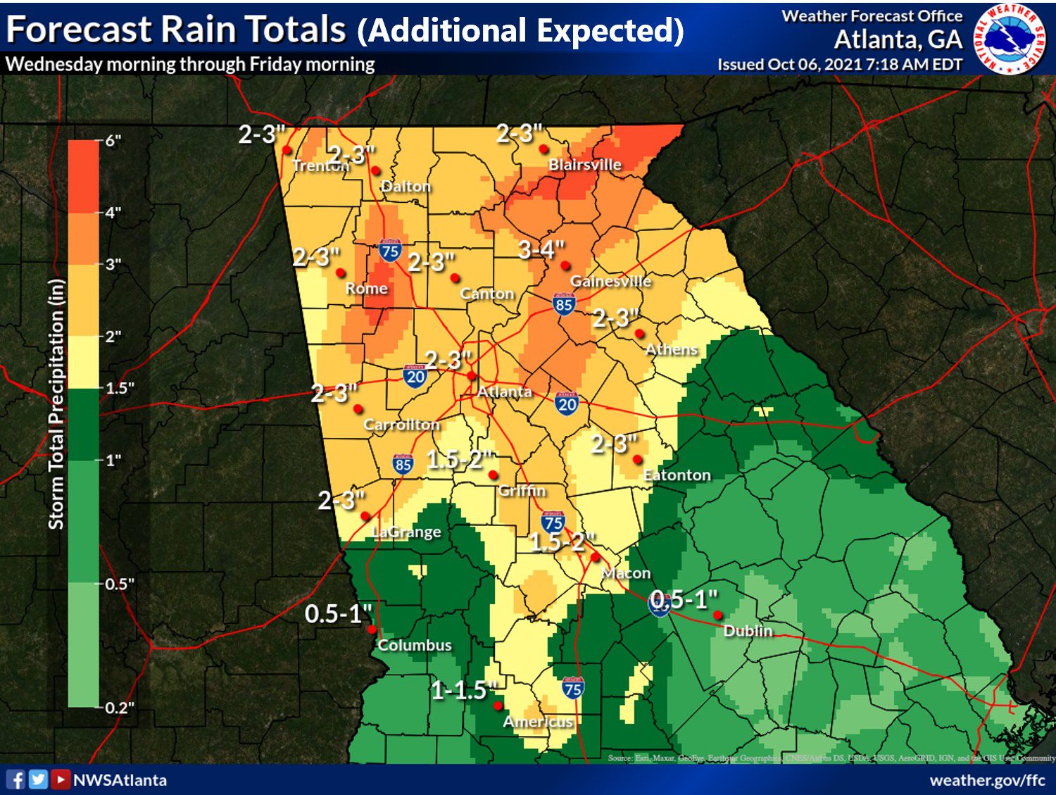
HIAWASSEE, Ga – Towns County remains under a flash flood watch until October 7 at 8 p.m.
Much of north Georgia is under the watch including all surrounding counties.
The National Weather Service Office out of Peachtree City (NWS) cautioned residents to pay attention to later forecasts in case they need to take action.
In a longer weather report, NWS stated:
“Rounds of moderate to heavy rain with embedded thunderstorms are expected through Thursday evening. Widespread additional rainfall totals of one to three inches are forecast across the watch area. Locally higher amounts will be possible, especially across north and northeast Georgia. The potential for localized flash flooding and quick rises on rivers and creeks will continue through Thursday, given the wet ground and above normal streamflows across the watch area. Several rivers and creeks have already responded to previous heavy rainfall.”
The weather appears to improve by the weekend.
Severe weather forecasted for Sunday afternoon to Monday morning
Announcements, News April 12, 2020
HIAWASSEE, Ga – The National Weather Service Peachtree City (NWS) office has issued several severe weather warnings for North Georgia from Sunday into Monday.
From the NWS:
“There is an Enhanced Risk of severe thunderstorms, including tornadoes, across much of north and central Georgia this afternoon through early Monday morning, with a moderate risk for parts of northwest Georgia. Damaging wind gusts and large hail are also likely. Flash flooding will also be possible over parts of far north Georgia this afternoon and overnight. River levels may remain high through early next week.”
A wind advisory also goes into effect at 6 p.m. and will last until 6 a.m. on Monday, April 13. South winds between 15 to 25 mph with gusts up to 35 mph are expected.
NWS warns of possible tree limbs falling and power outages in the area due to the high winds. The service recommends to secure outdoor objects and take caution if operating a “high profile vehicle.”
Finally, North Georgia should be on the lookout for potential flash flooding as a watch will be in place until Monday morning.

Forecast map from NWS.
“Periods of showers and thunderstorms are expected this afternoon through early Monday morning. Rain will be moderate to heavy at times with localized flooding possible. Rainfall totals of 2 to 4 inches are possible. Runoff from this rain will lead to a threat of flash flooding.” – NWS
Counties included in the issued warning and watches include Union, Towns, Fannin, Murray, Gordon, Lumpkin, Dawson, White, and Pickens.